
From road to street (IV): Boiro
The starting point in the urban section of Boiro is similar to that of other sections of the AC-305 as it passes through the nuclei of the coastal settlements: a public space designed around the vehicle, in which the surfaces dedicated to road traffic predominate. In addition, the punctual implementation of services and other infrastructural elements, following the logic of immediacy and ease of execution, has resulted in the fragmentation of space for people.


Crossroads between AC-305 and Rúa do Cruceiro.
Boiro is a municipality located on the southern slope of the Sierra del Barbanza, occupying a privileged position in the Arousa estuary. Its nucleus has not always been as we know it today nor has it occupied the same position throughout history. The current Boiro began to be shaped and configured at the end of the fifties, being located around a crossroads between the nearby towns: Cabo de Cruz, Escarabote and Abanqueiro-Cespón. This new area began to develop thanks to the creation of a town hall and a school in 1957. Both buildings were located in an agricultural area with farms, known as Solares de Bao, south of the Ribeira-Padrón road (now AC-305).
The main economic and development vector of Boiro is the canning industry, which generates direct and indirect employment. This activity is related to Barraña Bay, the main shellfish shellfishing area.
The development of the core of Boiro in the form of expansion represents a social and commercial gravitational change from the foundational core of Cimadevila to the new rationalist development. In the center of Boiro there are three distinct building fabrics: the traditional urban plots, the expansion and the equipment areas.
The traditional fabric is located in the northern part of the nucleus. It presents a greater dispersion and lower building density, being mostly groups of single-family houses. However, as it approaches the AC-305, the building typology changes to blocks of apartments, generally with first floor + 3 floors. At certain points, both typologies coexist. Currently it is difficult to recognize the original traditional plot, as successive urban growth has blurred it.
The urban grid of the urban expansion is radically different. The road network is planned, so its layout is more rational, creating blocks of similar size. It is a much denser and more compact area, although there are still undeveloped plots of land. The expansion has come to be considered the new centrality of Boiro, since it absorbs most of the population and basic services and stores.
The equipment areas are located either in front of the expansion or close to the beach. According to the current planning, it is foreseen that these facilities will be surrounded, in the future, by new urban growth that intertwines industrial and residential uses. Low-density housing is planned for the beachfront.
Currently the AC-305 runs slightly parallel to the sea line and acts as a division between the traditional urban fabric and the widening area of Boiro, hindering the natural transition on foot between the two parts. The widening area, the new centrality of Boiro, is composed of three parallel axes that converge at the same points: the AC-305, known locally as the main street; the line formed by the streets Pablo Iglesias, Doutor Santos Mieites and Estatuto de Galicia, popularly known as the pedestrian street; and the Avenida de la Constitución. Each of these streets has a very definite identity and is perceived by the neighborhood in different ways.
Year
2022
Promoter
Xunta de Galicia - Conselleria de infraestruturas e mobilidade - Axencia Galega de Infraestruturas
Fundación RIA
Location
Boiro, A Coruña
Team and collaborators
Fundación RIA
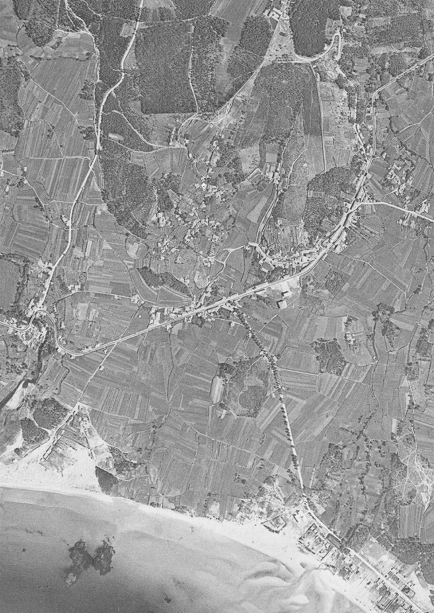
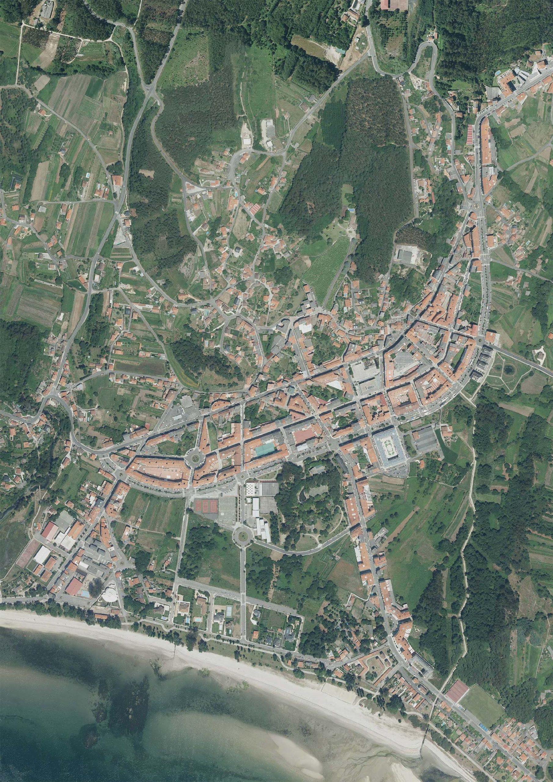
Orthophotography of the nucleus of Boiro.
Field work
The analysis of the section of the AC-305 in Boiro, like the rest of the sections, relies on information provided by official public data sources, local experts and, above all, field work.
Manual data collection
In order to gather the necessary information, several visits to Boiro are made. The first ones have the objective of approaching the place in a generic way. The environment is visited, both on foot and by car, to identify and experience in first person the existing problems. We also photograph, at street level and from a bird's eye view, what is identified as remarkable and relevant to know and explain the reality of the AC-305 in Boiro.
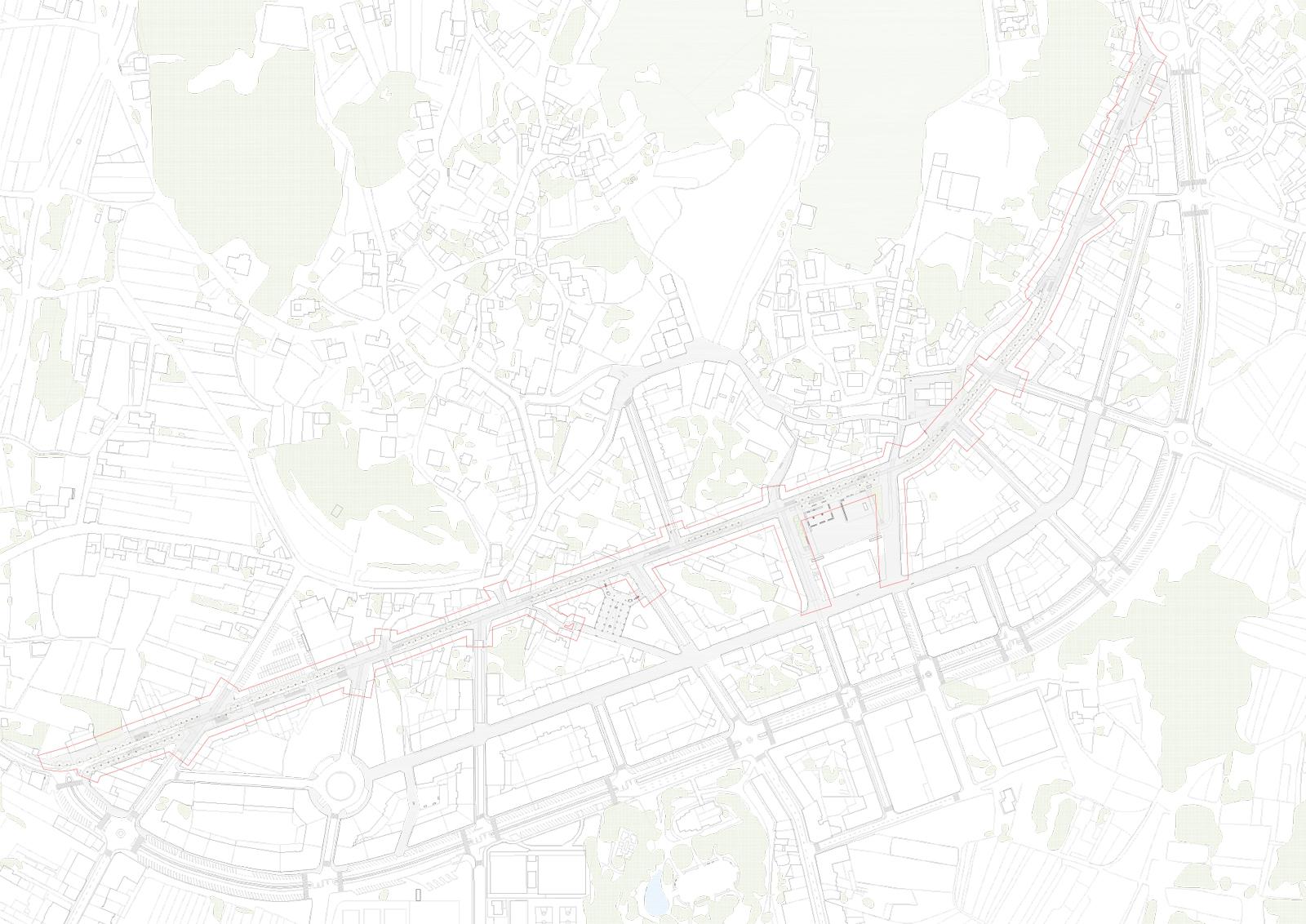
In the subsequent visits, the objective was to map in detail the elements and dynamics that exist in the public space of the chosen section. In addition to the photographs, the entire route of the road is redrawn by hand in order to make an exhaustive and detailed approach of the current state. This work allows us to generate a cartography faithful to reality, as well as to know the state of the buildings and stores.

Updated mapping of the public space (click to enlarge)
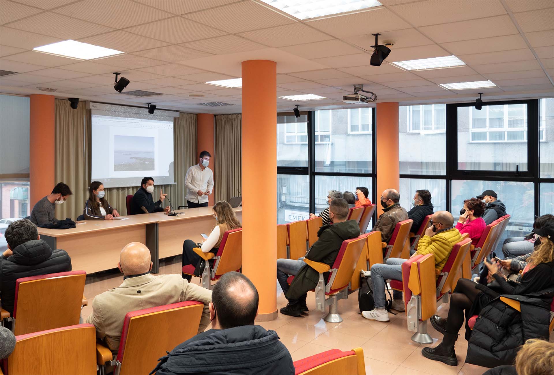
Local participation
The participatory events seek to encourage debate with the local population to incorporate subjective criteria on the safety of the road and reflect on the heritage, urban and identity values of the environment. The day allows to reflect and contrast information about the scope of work, the Rúa Principal de Boiro. Through the participation of representatives of the local community, a journey through the memory and identity of the street is made, highlighting its characteristic values and identifying its needs. The event has three parts:
Preliminary analysis: This is a 20-minute presentation by Fundación RIA, describing the context of the study and the principles on which it is based. Photographs and videos are used to present some of the conflicts identified in the Rúa Principal boirense and the potential for improving the environment.
Memory of Place: Representatives of the local community provide a historical overview of the work area, focusing on the memory and identity of the place.
Debate and surveys: After the presentations, a debate is opened with the attendees moderated by the team of Fundación RIA and focused on mobility and public space of the AC-305 in Boiro. Attendees are asked to respond anonymously to a survey from which several conclusions are drawn about how people live and perceive the space of the AC-305 in Boiro:
- The most commonly used modes of transportation are by private vehicle and on foot.
- The most common reasons for commuting were to go to work and to make purchases in the establishments in the area. This indicates that most of those attending the event work in the stores along the AC-305.
- The biggest deficiencies are the perception of darkness on the street and the amount of traffic.
- Most of the attendees share a vision of a future with less traffic, more sidewalks and trees.
Information and discussion day open to the public in Boiro.
Analysis
Once all the data necessary to generate a real and updated cartography of Boiro has been collected, a series of analyses are carried out to help to know the reality of this, in order to subsequently make a proposal that best suits the real context and the main needs of the section.
Several analytical plans are made such as: visuals from the AC-305, mobility generating points, building condition, first floor uses, vegetation, furniture, waste, lighting, supply elements in the public space, crosswalks, traffic direction and speed, signage, parking areas, general parking by sections, accesses, protection elements, accidents and public transport. Many of them accompanied by images and diagrams that accompany the explanation of each analysis.
As an example of these analytical plans, the image on the right shows the plan referring to mobility generating points. Mobility generating points are considered to be those facilities or establishments that attract population on a daily basis.
The points of attraction are differentiated according to whether the mobility generated is pedestrian or vehicular. The latter includes facilities and establishments that have parking areas nearby, which facilitate and encourage their arrival by private vehicle.
In addition, they are categorized according to whether they are private (light) or public (dark). For the former, commercial premises with a daily flow of people are considered, such as supermarkets, pharmacies, tobacconists, bakeries, bars and cafeterias. The public mobility generating points include cultural, educational and religious facilities.
Public facilities are identified throughout the core, since they have a strong attraction of population and can affect the dynamics of mobility of the AC-305, especially at intersections. However, private facilities have only been identified in the section of the AC-305, which is within the scope of the study.

Proposal
The starting point in the urban section of Boiro is similar to that of other sections of the AC-305 as it passes through the nuclei of the coastal settlements: a public space designed around the vehicle, in which the surfaces dedicated to road traffic predominate. In addition, the punctual implementation of services and other infrastructural elements, following the logic of immediacy and ease of execution, has resulted in the fragmentation of space for people.
The proposal aims to convert this section, currently a road, into a street. This work details the new logics by which the free space between facades should be designed when it crosses an urban nucleus (a street or a square). The objective is to recover the space and its character as a slow road, silencing the infrastructure to give back the protagonism to the people who live and work there.
Based on the analysis carried out, a series of action strategies are established that seek to take advantage of the potentials identified and to combat the existing deficiencies in the section studied. In general terms, the aim is to guarantee the safety of the road users and to reinforce the urban identity of the center. The aim is to recover the residential and business attractiveness by giving priority to pedestrians and promoting non-motorized internal displacements.

Historical photograph of the main street of Boiro showing the great presence of vegetation in the public space.
The main criterion for delimiting the scope of action is that the space is contained between private facades or closures. If the open space is private, but has no enclosure and is at a difference in height of less than 1 meter from the publicly owned open space, it is incorporated into the scope of action as it is visually and physically part of the same space. Therefore, it is necessary to seek the fit to encourage the owners to allow the action. If the above is complied with but it is not a totally free space, for example, if there is a cantilever, a free first floor or a pergola, each case will be considered on a case-by-case basis.
At crossings and detours, the delimitation will extend between 2 and 3 meters in the direction of the crossing generally. Exceptionally, the delimitation will be extended transversally when the crossing has a nearby closure (in which case it would be valued as a façade), when actions are proposed that extend transversely (such as crossings, single platforms, alignments and urbanization of public spaces) and, finally, when there are nearby elements or places of special interest (equipment, consolidated public spaces, heritage elements, etc.).
Scope of the proposal.
Reduction of road space
The road space reduction strategy has two objectives: to adapt the road to the new reduced speed and to increase the pedestrian surface to improve the quality of public space.
The AC-305 in Boiro presents, in the great majority of the section, a very reduced section in which the spaces destined to circulation and parking are very tight. At the narrowest points it has both traffic lanes of 2.70 m each and a parking lane, bus stop, and loading and unloading of 2.50 m wide, which results in a starting situation hardly reversible in favor of mobility on foot.
The proposal identifies the need to maintain a minimum strip for parking, bus stops and loading and unloading, in order to ensure urban activity in the section. Although this is proposed discontinuously, in those areas where it would be desirable to maintain this type of space, it is not possible to change the section with respect to the current one. It is therefore concluded that the only way to comply with the strategy is to propose the section with a single direction of traffic, so that the space currently used for one of the lanes becomes pedestrian.
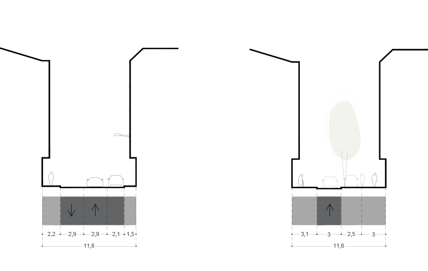
Road space reduction strategy.


